Amended 8/4/2012 You are here: Jubilee River Home Page > Jubilee River - key facts > Kingsmead Quarry - 0030 > How to contact me > Jubilee River guided tours
UNDER CONSTRUCTION
< PREVIOUS PAGE NEXT PAGE > KINGSMEAD QUARRY INDEX >
Kingsmead Quarry - A bit of history and a map
The local gravel beds in the Lower Thames Valley were created and laid down at the end of the last Ice Age. The strategic importance of gravel in the manufacture of concrete was recognised and acknowledged by the granting of permissions to extract in the 1940's. These in perpetuity permissions came with very few strings attached.
In the case of Kingsmead Quarry in Horton (Royal Borough of Windsor and Maidenhead) - the Western section bounded by Datchet Road, Welley Road and the Railway line is now effectively worked out and the equipment has moved to the Eastern side of the site - accessed via Stanwell Road.
In 1988 the railway bridge adjacent to Wraysbury Station collapsed due to interference with the local watercourses.
| 0002r | Wraysbury Railway Bridge collapse - images - May 1988 |
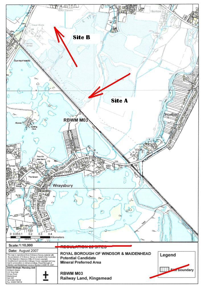
The areas where slurry operations are known to have taken place at Kingsmead are marked by the red arrows on the RBWM minerals map below.
They are marked 'Site A' and 'Site B' in the order that I became aware of them.
If you know of other sites, please let me know.